Venable-Comanche Loop – Sangre de Cristo Mountains, Colorado
The Venable-Comanche Loop was the most challenging of my hikes in the Sangre this summer. Although, not my most challenging hike ever, it did remind me of the dangers that can befall those who venture into these remote places… and the rewarding beauty that can be experienced in the Colorado backcountry.
This was another hike I’d had my eyes on for a couple years and was happy to finally get a chance to experience it. It was indeed another amazing mountain experience!
The trail starts at the Comanche-Venable Trailhead, which is very near the Alvarado campground at the end of County Road 140 (Schoolfield Road) south and west of Westcliffe off Colorado Highway 69. There are a few turns along this road. I’ve read where some folks have had a hard time finding the trailhead. Just study up on the area; know where you’re going beforehand; even pin the location for you GPS if you like. It’s not difficult for those who come prepared.
From the trailhead it’s a short feeder trail to the Rainbow trail (.47 miles) and another very short distance north (less than a tenth of a mile) to connect to the Venable Lake Trail going west.
At near 2 miles up this trail are the Venable Falls, a short distance from the trail for viewing, where the creek is routed through a steep and narrow canyon. Be careful viewing this as the terrain is dangerous. I didn’t get any pictures here, mostly because I had a bad camera setting. But it is spectacular. Enjoy!
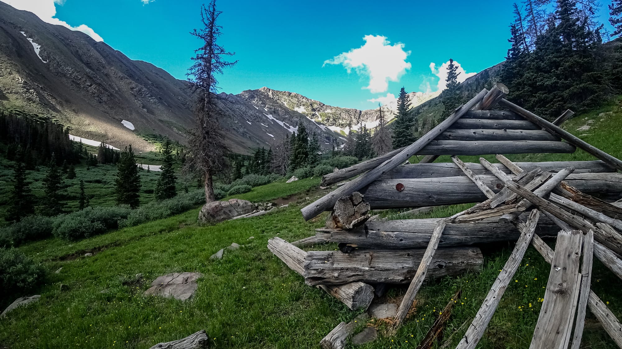
There are a couple small lakes on the map, before the switchback climb up to the Lower Venable Lake, but these are difficult at access through the thick brush and are easily viewed from the ascent trail. Also at these lower lakes are the ruins of an old cabin. This is great place to take a short break and enjoy the view.
From the falls to Lower Venable Lake is 2 miles. This lake is above tree line at 12,000 feet above sea level and is very easily accessible from the trail. For those continuing to take the loop to Camanche Trail, this is a great place to fill up on water.
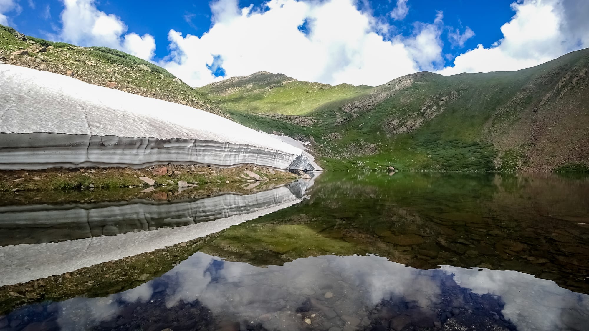
From here I took a short hike around the lake and up to the Upper Venable Lake. There’s only a very faint trail here, but it’s easy to navigate. My arrival was perfectly timed for a picture of the ice still melting away from the lake. I won’t try to describe it. See below.
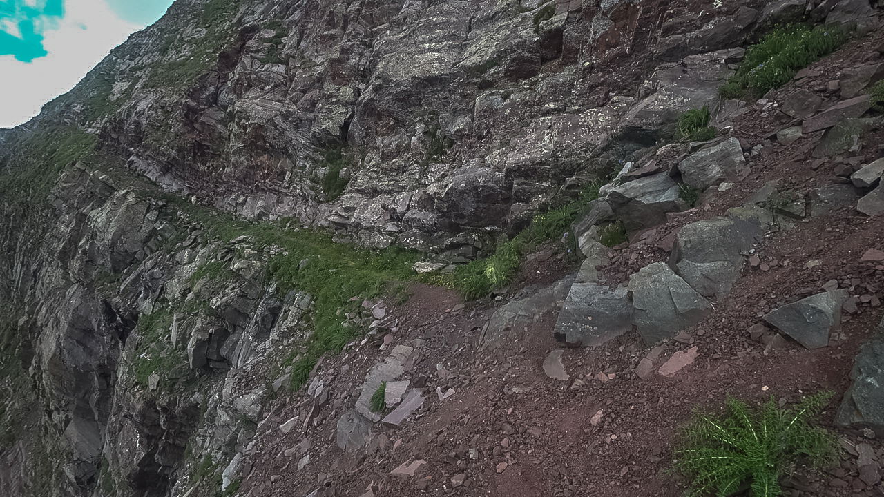
The Venable Trail and the Comanche Trail are connected by a trail segment called Phantom Terrace. The trail is faint in some places, about a mile long, and gains approximately 800 feet from Lower Venable Lake to the Comanche Trail connector.
The Phantom Terrace is best described as a ledge, sometimes narrow with some exposure, across the side of Venable Peak. From a distance it looks, as the name suggests, scary. But, for the most part it’s comfortably wide and easy to traverse. I’m erring on the side of caution here because there are a few places where the trail has eroded, and one should be careful stepping across these. One wrong step in the wrong place on this trail could result in a bad experience down the side of a mountain. So, have fun but be careful.
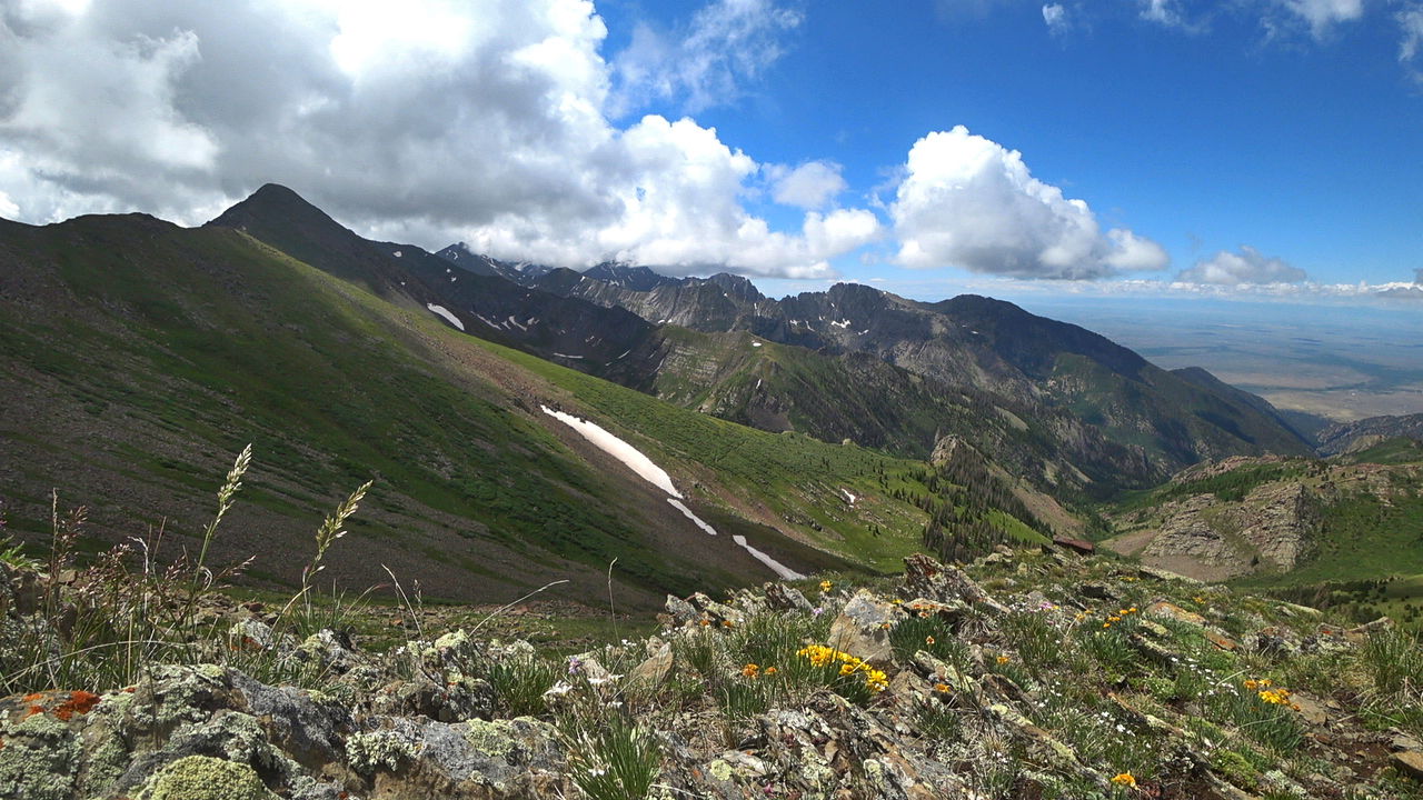
The view at the start of the Comanche Trail connector is breathtaking. It’s textbook Colorado. And this view can be enjoyed for the next mile as the trail goes along the south and west side of Spring Mountain to the saddle below Comanche Peak. Walk slow here because you’ll find your eyes and heart mesmerized by the surreal beauty, which means you won’t be paying attention to where you’re walking.
From the pass it’s 1.4 miles to Comanche Lake and another 3.8 miles back to the trailhead.
This trail was even more spectacular than I had read about in all the trip reports. If you only have a short while to spend in the Sangre, put this one on the short list. It’s amazing.