Lakes of the Clouds – Sangre de Cristo Mountains, Colorado
I had wanted to do Lakes of the Clouds trail for some time. Back in western Upper Michigan where I grew up there is a place called Lake of the Clouds in the Porcupine Mountains along Lake Superior. This probably wouldn't be anything like that experience, but I had to go check it out.
Of course, in Colorado the elevation is much higher. The trail starts at 9200 feet compared to Michigan at around 1000 feet in elevation. The scenery I imagined would be much like one would expect of a Colorado alpine lake. Not to diminish the beauty of the northern Midwest; each place holds its own beauty. But today was the day to satisfy the curiosity that had been building in me about what Colorado could bring to a name of which I am so familiar.
Starting at Gibson Trailhead, the feeder trail connects with the Rainbow Trail north. In a half mile the trail intersects with Swift Creek trail (I took this trail back). One third mile later the trail crosses Swift Creek and then continues another .85 miles until it intersects with the Lakes of the Clouds trail heading west. In 2.7 miles up the Lakes of the Clouds trail it intersect with the other end of Swift Creek trail. From there the first lake is .8 miles away. The other two lakes are close by.
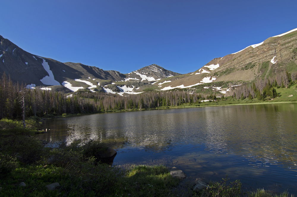
As I approached the first lake, the climb intensified. I walked through the few remaining patches of snow at tree line (it was July 15th) just prior to reaching the lake. This made arriving at the lake especially satisfying. And, I might add, the mosquitoes on the approach were populous and hungry.
This was the first time I used the CoTrex app on my phone. It was very helpful in navigating the trail to each of these lakes as there are many social paths in this area that lead to fishing or camping spots in the area.
The hike is moderately populated, raising 2600 feet in elevation along an 11 mile out and back trail. The trail does get rocky and steep in some places, but overall a somewhat normal experience for the Sangre.
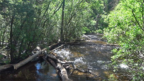
I took the Swift Creek trail on the way back. In early summer this route can be a little muddy and buggy in places. Swift Creek can a be… well, swift… and somewhat challenging to cross during the early runoff. When considering this trail, be aware that there is no man-made bridge for the crossing. The pic below shows what it looked like crossing the creek. It wasn't deep, so it easily passable by just walking across it - if you don't mind having wet feet. But I chose to balance on the logs.
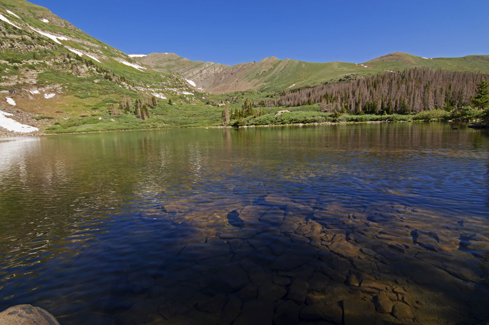
The scenery at these lakes, as with all my Sangre hikes this year, is amazing and most definitely worth the effort. Most of the lakes are contained in bowls below very aggressively rising rock faces, setting up dramatic and contrasting lines between the flat calming effect of the water and the sharply upward ascending summits of sentinel-like peaks. And in the background are higher and even more rugged and expansive mountains, layered and shaping what seems like an unreachable horizon. The depth and mass of it all makes one feel small and insignificant, yet empowered, energized, and even overcome by feelings of blessedness. There’s nothing like a good healthy dose of nature to refresh the spirit!